A Treasure Arrives at Shetland Archives
We’ve just received one of our most beautiful donations - a stunning collection of 19th-century papers including two intricate hand-drawn maps by Andrew Dishington Mathewson of Mid Yell.
The Shetland Archives has received a splendid donation of papers by Andrew Dishington Mathewson from Mid Yell. He and his family are the subject of the recent book edited by Ken Carpenter, Shetlanders by Penny Post (2024).
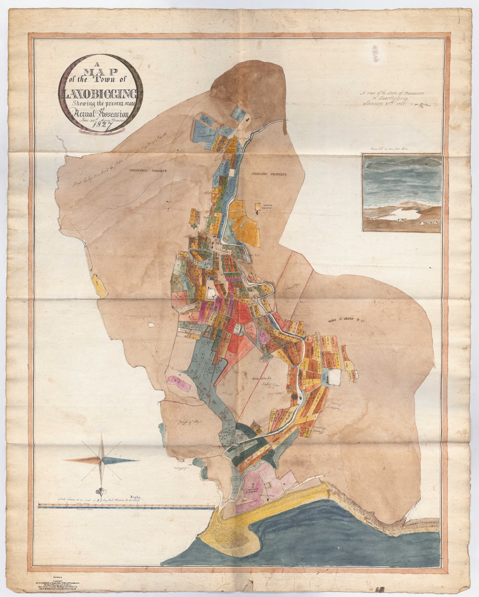
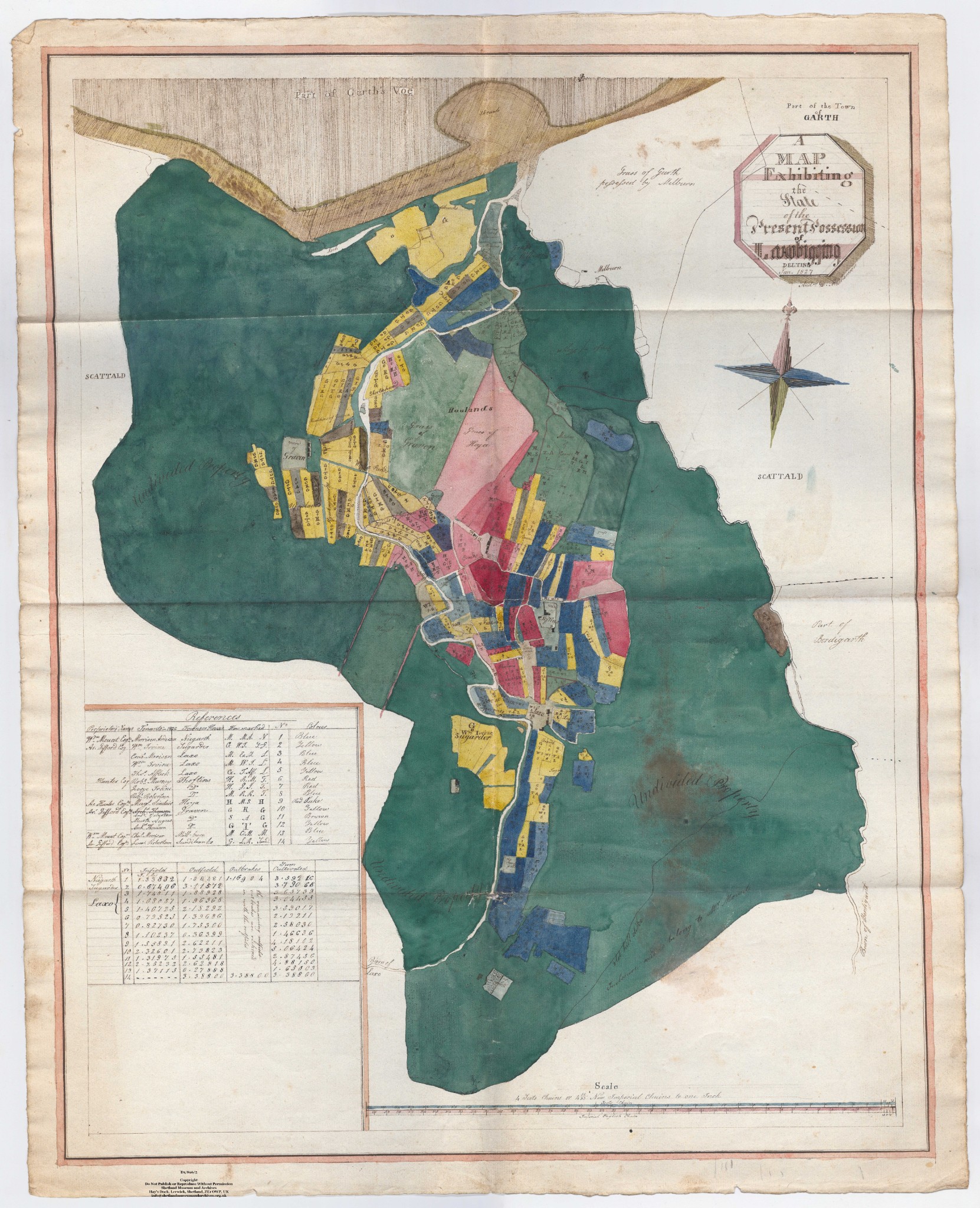
Although he was a schoolteacher, Mathewson had a second job. He was a land surveyor. Invitations came to him from landowners to make surveys and draw maps of their properties. He walked all over Shetland to fulfil these commissions.
Mathewson was a skilful surveyor. His writing and his drawings are beautiful. Sometimes his employers thought that he had gone a little far in recording too much detail. In the 1820s he prepared an extraordinary plan of Funzie in Fetlar. One of the landowners said that it was ‘absurd’, since every rig in the place was recorded and named.
At that time arable land in the islands was divided into hundreds of rigs, tiny pieces of land. The system was called ‘runrig’. The tenants liked it, no doubt because they thought that everyone could get a good share of good and bad land. The landlords were less keen, because they wanted their own land to be separate from the property of other owners, rather than hopelessly mixed up.
In 1826 Mathewson got a commission from the owners of Laxobigging in Delting, now usually called Graven. He seems to have started the work in the middle of winter. Once more, as can be seen from his maps, he drew every little rig in the place, and gave each of them its name. These names have long disappeared, and only survive in Mathewson’s survey.
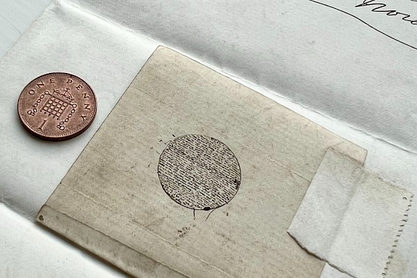
Mathewson’s work is exquisitely detailed, from meticulously recorded runrig fields to what may be the earliest pictorial view of Ronas Hill from Laxo (see below).

He computed the extent and value of every class of land: arable and grass, and noted who was tenant of every ‘parcel’. These papers are the best evidence for runrig anywhere – a kind of agriculture that has disappeared from the world.
In 1998 the late Willie Thomson wrote a brilliant article about Mathewson’s surveys at Laxobigging, Funzie, and Norwick in Unst, and the ‘highly complicated, fragmented and dispersed landscape’ that was typical in Shetland at that time. It is thanks to Andrew D. Mathewson’s meticulous work, 200 years ago, that we understand how runrig worked.
An extract from the 'Survey of Laxobigging' can be seen below, you can view the paper in full on our online archive.